

 DJI Enterprise
1 586,00 € Incl. VAT
Optimal Accuracy, Extended Range
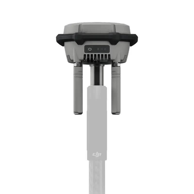
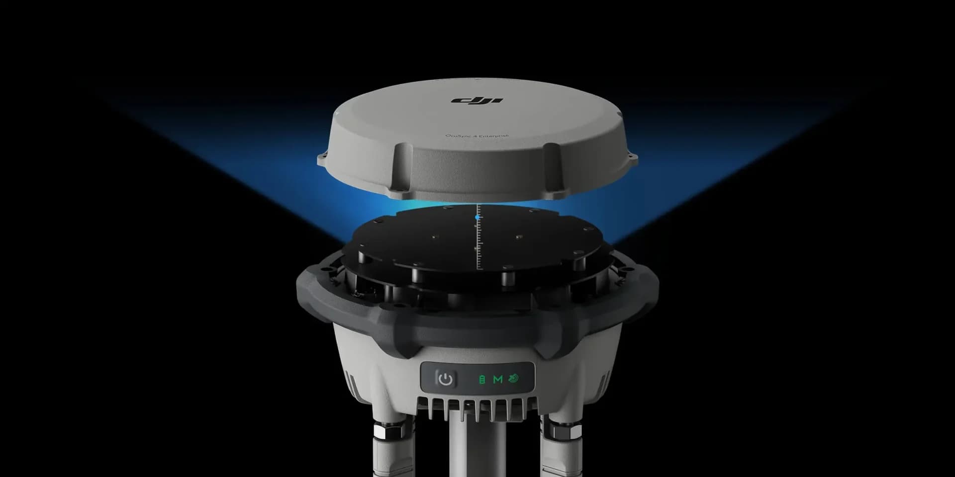
The new D-RTK 3 Multifunctional Station is equipped with high-performance antennas and receivers. It can track and process data from the world’s major global navigation satellite systems (GNSS) and supports multiple data transmission links.
Thanks to these advanced features, it can serve as a reference station, providing centimeter-level positioning accuracy for multiple drones simultaneously. It can also extend the operational range of drones when used in Relay Station mode.
In addition, the new Rover Station mode, combined with the DJI Enterprise app and DJI Terra, provides a comprehensive solution for high-precision aerial surveying. This ensures safe and accurate operations.
D-RTK 3 Multifunctional Station
- Base, Rover, and Relay modes
- PPP, dm-level positioning without a network connection
- High-precision GCP/CP
Base Station: Supports Simultaneous Operation of Multiple Models
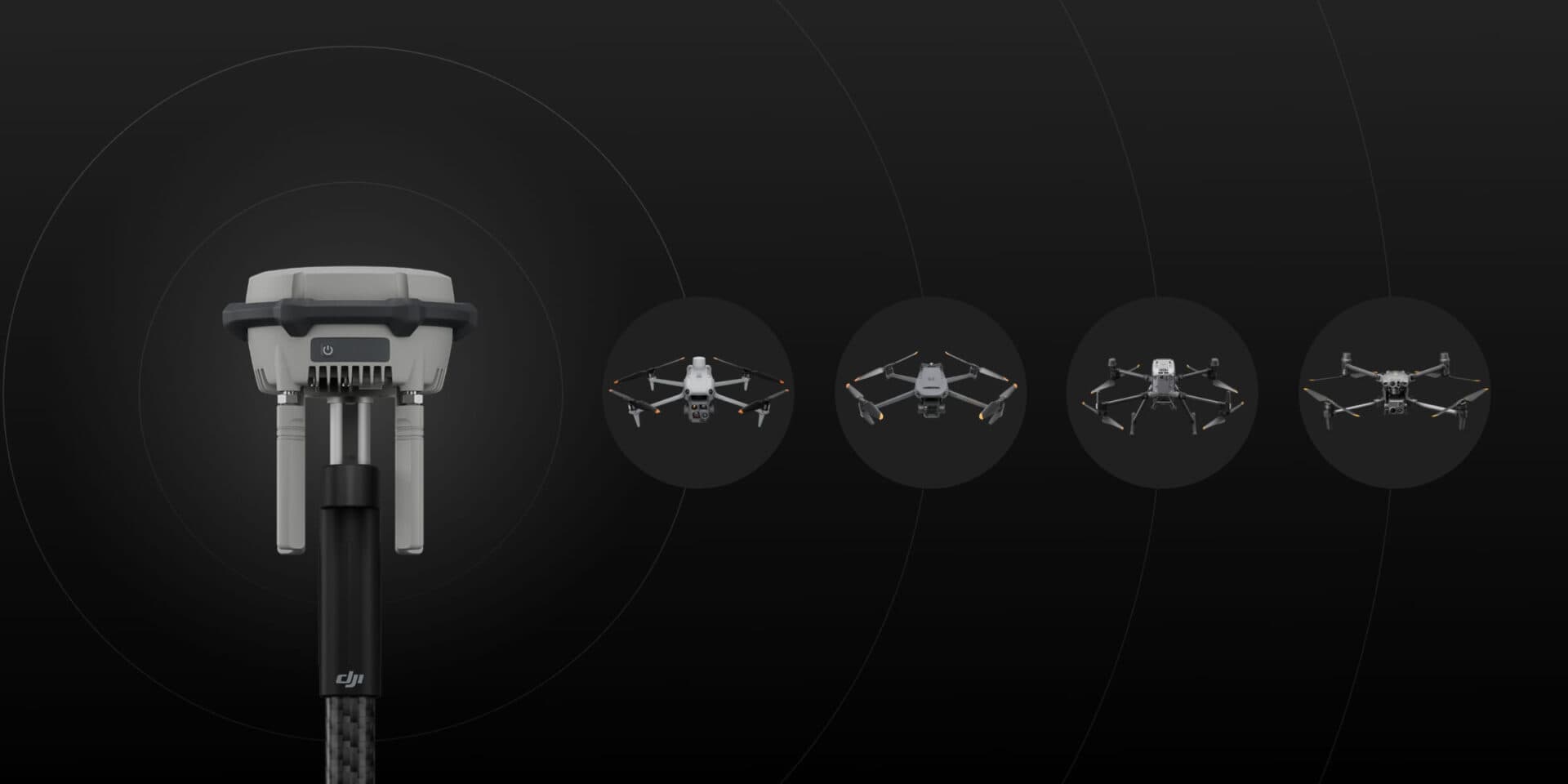
The D-RTK 3 supports the new O4 Enterprise video transmission system with four external directional antennas. This enables video transmission over distances of up to 15 km in Base Station Broadcast mode, while ensuring stable signals in all directions.
Operators only need a single D-RTK 3 Multifunctional Station. Without any additional configuration, multiple drones can connect to the base station and benefit from centimeter-level positioning accuracy.
Relay Station Mode
Switch the D-RTK 3 to Relay Station mode and install it in an elevated location in areas where signal obstruction is significant, such as urban environments or valleys. This helps increase the video transmission distance and extend the operational range of the Matrice 4 series to up to 25 km.
Push the Limits
The D-RTK 3 supports obstacle detection with the Matrice 4 series, enabling real-time calculations of obstacles and signal quality between the relay station, as well as between the remote controller and the drone.
Operators can also adjust the drone’s position based on the indications provided by the remote controller to ensure optimal communication quality.
Flexible and Efficient Rover Station Mode
In addition to serving as a base station, the D-RTK 3 can also be used as a rover station to collect ground control point coordinates. This improves the accuracy and precision of UAV aerial surveying.
D-RTK 3 Multifunctional Station Features
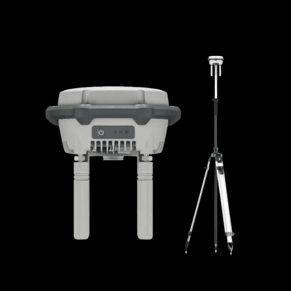
Compact Size : Ø 163 mm × 89 mm, 1.26 kg, fits in the palm of your hand
Physical Buttons : Physical buttons and indicator lights for powering on/off, switching modes, and displaying status
Adaptability : Standard 5/8-inch thread, making it easy to use with third-party tripods. USB Type-C port on the bottom for charging and debugging
OcuSync 4 Enterprise : Four external antennas. Max. 25 km
High-Performance Core : Self-developed RTK chip offering excellent stability, high-performance air-dielectric antenna with physical filtering design, and center-phase accuracy of ≤ 2 mm. Self-developed positioning algorithm with a high received signal-to-noise ratio (SNR)
Long Endurance : 4 h / Relay, 7 h / Base, 10 h / Rover
High Durability : IP67, -20°C to 55°C*
* Tested for a 2 m drop onto a pole
Note : DJI offers an optional self-locking pole and dual-locking tripods, available separately.
Base Station Workflow
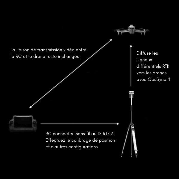
- Switch the D-RTK 3 to Base Station mode (green LED).
- Use the RC to select D-RTK Base Station as the RTK Service Type.
- Search for and connect to the D-RTK 3.
- Calibrate the coordinates for the D-RTK 3.
- The D-RTK 3 directly broadcasts RTK correction signals to the aircraft.
- The video transmission link between the RC and the drone remains unchanged and does not pass through the D-RTK 3.
Note : In Base Station mode, there is no upper limit on the number of drones that can be connected to a single D-RTK 3.
Superior Performance, More Precise Positioning
The D-RTK 3 uses a filtered air-dielectric antenna to effectively track low-elevation satellites. In addition, the antenna’s phase-center accuracy is maintained at the millimeter level, providing strong resistance to multipath interference. This enables high-precision positioning even in complex environments.
Thanks to its integrated receiver module, the D-RTK 3 can receive satellite data from five major satellite systems across 19 frequency bands. Compared with network RTK, the D-RTK 3 provides more accurate and stable positioning results under ionospheric effects.
Autonomous PPP (Precise Point Positioning)
The D-RTK 3 uses DJI’s proprietary PPP solution, enabling automatic satellite-based convergence. It provides decimeter-level positioning without a network connection, even in challenging network conditions.
* Currently supports BeiDou PPP-B2b only.
High-Precision Network Calibration
The D-RTK 3 can receive RTCM data and automatically obtain accurate coordinates and positioning information via the network. When used outdoors, it can achieve centimeter-level positioning accuracy without the need to pre-survey the installation point.
Rover Workflow
Operating Steps
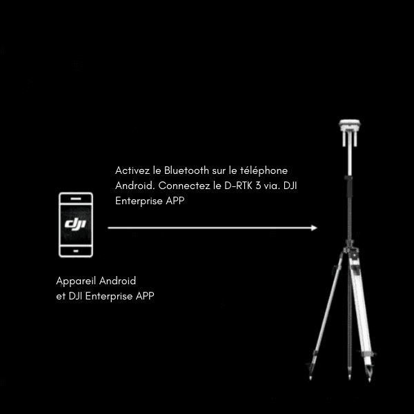
- Download and install the APK file for the DJI Enterprise app.
- Switch the D-RTK 3 to Rover mode (yellow LED).
- Enable Bluetooth on the Android phone.
- Connect the D-RTK 3 via the DJI Enterprise app.
- Enter the CORS configuration information to start the survey.
Note : The DJI Enterprise app can also be used on the RC Plus 2 Enterprise remote controller. The DJI Enterprise app can be downloaded from the DJI D-RTK 3 product website.
DJI Integrated Mapping Solution
New DJI Enterprise App
Supports Ground Control Point (GCP) Configuration and Tilt Compensation
Install the new DJI Enterprise app on an Android device to measure ground control point coordinates without third-party tools. When used with DJI drones that support RTK, the DJI solution can efficiently complete an entire high-precision surveying workflow.
In addition, the D-RTK 3 features a high-precision built-in inertial measurement unit (IMU). This allows operators to measure control points while holding the pole at an angle, without using a tripod, or ensure that the base station is positioned vertically, significantly improving operational efficiency in complex surveying environments.
Supports Projected Coordinate Conversion
The new DJI Enterprise app includes a database of commonly used projected coordinate systems, enabling the direct output of planar coordinates.
Compatible with DJI Terra for Efficient Data Processing
One-Click Import, Save Time and Effort
Rover survey results can be exported as ground control point files through the DJI Enterprise app and imported directly into DJI Terra without requiring any format conversion. High-precision results can then be easily generated using powerful algorithms.
Supports Local PPK
The D-RTK 3 supports the recording of raw satellite observation data. When imported into DJI Terra version 4.4 or later together with data from the Matrice 4E, local PPK calculations can be performed with a single click.
Supported Models
GNSS Receiver
GNSS Frequency
GPS: L1C/A, L2C, L5
BDS: B1I, B2I, B3I, B1C, B2a, B2b
GALILEO: E1, E5a, E5b, E6
GLONASS: L1, L2
QZSS: L1C/A, L2C, L5
L-band
System Accuracy
Base Station and Relay Station Modes
Base Station Accuracy:
Single-point positioning accuracy (uncalibrated):
Horizontal: 1.5 m (RMS)
Vertical: 3.0 m (RMS)
Satellite Differential Positioning Accuracy:
Convergence time: 20 min
Horizontal: 30 cm (RMS)
Vertical: 40 cm (RMS)
RTK Network Calibration:
Horizontal: 1.0 cm (RMS) + 1 ppm
Vertical: 3.0 cm (RMS) + 1 ppm
Rover Station Mode*
RTK Accuracy (Fixed Survey):
Horizontal: 0.8 cm (RMS) + 1 ppm
Vertical: 1.5 cm (RMS) + 1 ppm
RTK Accuracy (Tilted Survey)***:
Tilt angle range: 0 to 60°
Horizontal: 8 mm + 0.7 mm/degree of tilt (accuracy < 2 cm at 30°)
Notes:
* Measurement accuracy depends on various factors. This value is obtained under normal conditions with an unobstructed view, good satellite reception, low ionospheric activity, and in the absence of electromagnetic interference or multipath effects.
** The accuracy of the base station calibration coordinates depends on various factors. For surveying, high-precision flight routes, and similar applications, it is recommended to perform calibration using four or more GNSS systems during periods of low ionospheric activity, in open and unobstructed environments, and in the absence of electromagnetic interference or multipath effects.
*** Strong vibrations and rapid rotations may affect the accuracy of the inertial measurement unit.
Precise Point Positioning by Satellite*
Supported frequencies: BDS B2b, GALILEO E6**, L-BAND**
Convergence time: 20 min
Horizontal: 30 cm (RMS)
Vertical: 40 cm (RMS)
Notes:
* Measurement accuracy depends on various factors. This value is obtained under normal conditions with an unobstructed view, good satellite reception, low ionospheric activity, and in the absence of electromagnetic interference or multipath effects.
** Support will be added in future versions.
Differential Data Transmission Format
When used as a base station or relay station, it records raw RTCM 3.2 observation data in DAT format.
In Rover Station mode or Calibration mode for base and relay stations:
- Supports RTCM v3.0, v3.1, v3.2, v3.3, MSM4, MSM5, MSM6, and MSM7 protocols.
- It is recommended to use receivers that support four or more GNSS systems.
Initialization Reliability
99.9%
Video Transmission
Video Transmission System
O4 Enterprise
Operating Frequency
Relay Station Mode:
O4: 2.4 GHz / 5.2 GHz / 5.8 GHz
Broadcast Mode:
O4: 2.4 GHz / 5.8 GHz
Rover Station Mode:
BLE: 2.4 GHz
The permitted operating frequency varies by country and region. For more information, please refer to local laws and regulations.
Transmitter Power (EIRP)
2.4000 GHz to 2.4835 GHz:
< 33 dBm (FCC)
< 20 dBm (CE/SRRC/MIC)
5.150 GHz to 5.250 GHz:
< 23 dBm (CE/FCC)
5.725 GHz to 5.850 GHz:
< 33 dBm (FCC)
< 30 dBm (SRRC)
< 14 dBm (CE)
Bluetooth
Protocol: Bluetooth 5.1
Frequency: 2.400 GHz to 2.4835 GHz
Transmitter Power (EIRP): < 10 dBm
Max. Transmission Distance (Unobstructed and Interference-Free)
Base Station Mode
Between D-RTK 3 and the aircraft:
FCC: 15 km
SRRC: 12 km
CE/JP: 8 km
Rover Station Mode:
Between D-RTK 3 and mobile devices: 30 m
Measured in an unobstructed and interference-free environment. The data above indicates the longest one-way communication range, without return flight, for each standard. Always pay attention to RTH prompts in the app during flight.
Max. Transmission Distance in Relay Station Mode (Unobstructed and Interference-Free)
FCC
Between the aircraft and the relay station: 25 km
Between the relay station and the remote controller: 1 km
SRRC
Between the aircraft and the relay station: 12 km
Between the relay station and the remote controller: 1 km
CE
Between the aircraft and the relay station: 10 km
Between the relay station and the remote controller: 300 m
Measured in an unobstructed and interference-free environment. The data above indicates the longest one-way communication range, without return flight, for each standard. Always pay attention to RTH prompts in the app during flight. The relay station should be placed in an elevated and unobstructed location to ensure clear communication between the remote controller and the aircraft.
Max. Transmission Distance in Relay Station Mode (Unobstructed, with Interference)
Strong interference: urban areas, approximately 1.5 to 5 km
Medium interference: suburban areas, approximately 5 to 15 km
Low interference: remote/coastal areas, approximately 15 to 25 km
The data was tested according to FCC standards in unobstructed environments with typical interference. For reference only; it does not guarantee the actual flight distance.
Max. Transmission Distance in Relay Station Mode (Obstructed, with Interference)
Low interference and obstruction from buildings: approximately 0 to 0.5 km
Low interference and obstruction from trees: approximately 0.5 to 3 km
The data was tested according to FCC standards in unobstructed environments with typical interference. For reference only; it does not guarantee the actual flight distance.
Antenna
4 × OcuSync 4 directional antennas, 2T4R
The antenna uses a standard reverse-polarity SMA connector.
Electrical Specifications
Power Consumption
Relay Station: 14.5 W (max. power consumption without heating; max. 36.5 W with heating)
Base Station: 7 W
Rover Station: 6.2 W
Supported Power Adapter
USB PD 3.0 protocol, 9 V to 15 V output voltage adapter (e.g., DJI 65W Portable Charger)
When using a non-recommended charger, such as a charger with a 5 V output, the D-RTK 3 can only be charged after it has been powered off.
Power Output Port
USB Type-C port
Operating Time (at Normal Temperature)*
Relay Station: 4 hours
Base Station: 7 hours
Rover Station: 10 hours
* Battery performance may decrease at low temperatures. It is recommended to use power adapters that support the USB PD 3.0 protocol.
Battery
LiPo
Capacity: 6,500 mAh
Energy: 46.8 Wh
Physical Specifications
Operating Temperature
-20°C to 55°C
- In normal-temperature environments, charging power will be limited if the device’s housing temperature exceeds 48°C. Full-power charging resumes once the environment has cooled down.
- After storage/use at low temperatures, the device must be moved to a normal-temperature environment and allowed to warm up until the internal battery temperature is >0°C before charging.
- After storage/use at high temperatures, the device must be moved to a normal-temperature environment and allowed to cool down until the internal battery temperature is <45°C before charging.
Altitude
6,000 m
Ingress Protection Rating
IP67*
* Ensure that all rubber interfaces on the body are properly installed.
Drop Resistance
2 m drop with pole
Dimensions
163 × 89 mm (without OcuSync directional antennas)
Weight
Approx. 1.26 kg (2.78 lbs)
Broadcast Mode (green indicator): Used to provide accurate positioning data for centimeter-level positioning, improving the operational accuracy of multiple DJI devices simultaneously. Relay Station Mode (blue indicator):* After connecting to the specified compatible DJI device and remote controller, the D-RTK 3 is installed in an elevated location and used as a communication relay to prevent signal obstruction during operation. Rover Station Mode (yellow indicator): Used as a portable surveying device to measure Ground Control Points (GCPs). * This feature is not available in countries or regions where 5 GHz frequency is not supported. Check local laws and regulations for more information.
Relay Station Mode and Broadcast Mode can be activated using DJI Pilot 2. If the remote controller firmware has not been updated, these modes can be activated via DJI Assistant 2 (Enterprise Series).
By default, Relay Station Mode and Broadcast Mode use the WGS84 coordinate system.
Rover Station Mode provides latitude, longitude, and altitude by default, with the coordinate system determined by the RTK source used. You can use the built-in coordinate conversion function in the DJI Enterprise app to convert these coordinates into standard projected coordinate formats.
The self-locking surveying pole has a diameter of 32 mm and an adjustable length ranging from 1.25 m to 2 m. The dual-locking tripod is 92 mm high.
Yes. This is supported in DJI Terra version 4.4.0 and later.
The D-RTK 3 Multifunctional Station supports Relay Station Mode, Broadcast Mode, and Rover Station Mode, and is compatible with multiple device models*. The D-RTK 3 AG Station only supports Broadcast Mode and is compatible with a limited number of device models.
* Refer to the product page on the official website for the list of supported models.
5/8″-11 UNC threaded hole.
- It can connect to multiple DJI devices in Broadcast Mode.
- It can connect to only one remote controller and its paired device in Relay Station Mode.
- It can be paired with only one mobile device via Bluetooth in Rover Station Mode.
The position output rate is 1 Hz in Broadcast Mode and Relay Station Mode.
The reserved port does not currently support any additional functions and cannot be removed. Do not attempt to open it, as doing so may affect the warranty.
B2b and E6 are frequency bands defined by international standards and used for satellite signal transmission. Currently, the BeiDou, Galileo, and GPS systems use B2b and E6 to transmit differential information via satellite. These signals enable high-precision PPP positioning without the need for a network, improving positioning accuracy when used independently.
Software support for analyzing the Galileo E6 frequency band will be available in future versions.
This small opening is used for the buzzer and does not affect the station’s protection rating.
- Check the device battery indicators.
- In Broadcast Mode, check the battery level and satellite information at the bottom of the RTK settings.
- In Relay Station Mode, connect to the DJI Enterprise app to view the battery level and satellite information.
- In Relay Station Mode, you can check the battery information in the status bar of the flight interface and in the RTK settings at the bottom.
Use a 13 mm open-end wrench to install and remove the antennas. A tightening torque of 15 kgf is recommended.
- Press the power button three times.
- Connect the D-RTK 3 to the remote controller via a USB-C cable and switch modes in the DJI Pilot 2 app.
Using DJI Assistant 2 (Enterprise Series)
Go to the RTK settings page on your device and select “D-RTK Base Station” as the RTK source. Then select the desired D-RTK device from the list of detected devices to establish the connection.
For future use, the device and remote controller will connect automatically once powered on. If the connection is not established automatically, you can initiate it manually in the RTK settings.
You can set coordinate points by accessing the Coordinate Calibration section in the RTK settings. The coordinates of the base station can be set using RTK Network Calibration, PPP Calibration, or Manual Calibration.
Press and hold the power button for 10 seconds to reset the password to the default “123456”.
No. The D-RTK 3 Multifunctional Station monitors its current position to detect any movement. When movement is detected, a movement warning appears in the app and the flight mission is interrupted, requiring the user to return and land the drone manually. The system will resume normal operation only after the D-RTK 3 Multifunctional Station has updated its position.
Install it in an unobstructed area where the antenna can effectively cover the surveying and takeoff areas. When using the surveying pole for installation and elevation, pay attention to the surrounding environment to avoid any risk of tipping over or electrical hazards.
A raw satellite observation data file is generated each time the device is powered on and powered off in Relay Station Mode or Broadcast Mode. To export the files, connect the device to a computer and copy the DAT files corresponding to the task time from the removable drive that appears. These files can then be processed using DJI Terra.
In the DJI Enterprise app settings, enter the NTRIP configuration information provided by your RTK network service provider to connect to the RTK network.
In the DJI Enterprise app, select “Mission Library”, then click “Export” to export Ground Control Points compatible with DJI Terra in JSON format and Ground Control Point results in CSV format.
In the DJI Enterprise app, tap the Tilt Compensation icon and follow the in-app instructions to complete the shaking and inertial navigation calibration and enable Tilt Compensation.
The DJI Enterprise app has built-in settings for this purpose. Simply enter the pole height directly when using the app. If you use a third-party surveying pole without height markings, the pole height is measured from the bottom tip of the pole to the nut joint once the pole is screwed into the main unit, excluding the portion of the pole screwed into the nut.
The Tilt Compensation function uses the device’s built-in IMU sensors to determine the current tilt angle of the device. The actual position of the pole tip is then determined using trigonometric calculations.
This function supports point marking in locations such as wall corners, road edges, and utility poles, where vertical point marking is difficult or impractical, allowing users to mark points at an angle.
You can use the Rover Station without installing the OcuSync directional antennas. However, prolonged removal may compromise the waterproofing of the antenna interfaces. Therefore, it is recommended to remove them only when absolutely necessary.
The Ground Control Point and check point data exported from the DJI Enterprise app are in JSON format. When using DJI Terra’s Ground Control Point Management function, you can import this data as Ground Control Points and check points with a single click, without having to select a data format.
- Turn on the remote controller and the aircraft and make sure they are successfully paired. On the DJI Pilot 2 app home screen, tap the Relay Pairing button, then select “Connect Relay Device” to enter pairing mode.
- Press and hold the power button on the D-RTK 3 Multifunctional Station for 5 seconds to enter linking mode. The mode indicator will flash during this process.
- Once the D-RTK 3 Multifunctional Station is linked to the remote controller and aircraft, the mode indicator will show a solid blue light.
To ensure optimal image transmission relay performance, install the D-RTK 3 Multifunctional Station in an elevated location (such as a rooftop) whenever possible. If you want to use the RTK relay function, the D-RTK 3 Multifunctional Station must be securely fixed in place, and its top must remain unobstructed.
Relay Station Mode is not available in countries or regions that do not support the 5 GHz frequency, such as Japan, Russia, and Kazakhstan. Only Base Station Mode and Rover Station Mode are supported in these countries.
In Relay Station Mode, if a previously paired drone remote controller and relay station are brought to Japan for use, the remote controller and aircraft will not be able to connect to the relay station. In addition, if you attempt to pair the remote controller with the relay station in Japan, the pairing will fail.
- Pair the new aircraft while the relay station is powered on.
- If the relay station is powered on after the new aircraft has been paired, you can reset the aircraft or remote controller, then pair it again with the relay station to establish a connection between all three devices.
Frequency pairing is only required in Relay Station Mode. In Relay Station Mode, select the Relay Station Pairing option on the remote controller, then press and hold the power button on the D-RTK 3 Multifunctional Station for 5 seconds to enter pairing mode.
In Relay Station Mode, the station connects simultaneously to the remote controller and the aircraft, while the remote controller also maintains a signal connection with the aircraft. During flight, the aircraft will switch between signal connection methods based on the actual flight environment. The remote controller’s flight interface will display only the combined signal strength.
Relay Station Mode can be used when obstacles in the aircraft’s takeoff area affect communication between the aircraft and the remote controller. Placing the relay station at an elevated location helps bypass obstacles and extend the signal control range.
The relay station can be installed in challenging site environments, allowing the pilot to operate the remote controller from a sheltered location, indoors, or from inside a vehicle.